We should remember the Inca kingdom had a strict cosmic kind of geography. First we have the quincunx diagram, here drawn as twins with Peru (Tawantinsuyu) at the top: 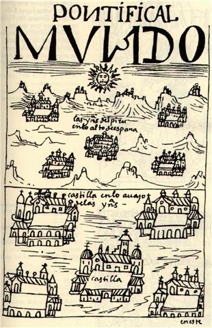 ... This illustration is from Ronald Wright, Cut Stones and Crossroads. A Journey in the Two Worlds of Peru. The 'pontificial world' (Pontifical Mundo) has Peru at the top and Spain at bottom, in both cases with the central edifices occupying the place of the Sun. Wright explains: [This is] Waman Puma's conception of the relationship between Peru and Spain according to the Andean duality principle of Hanan (Upper) and Hurin (Lower). Each country is shown as a Tawantinsuyu - four quarters with a capital in the center. Peru is higher, closer to the sun, and therefore full of gold, the 'sweat of the sun'. "... Space and time are a single, related concept in Runasimi [the language of the Inca people], represented by one word, pacha, which can also mean 'world' and 'universe'. The image of time familiar to Waman Puma was static and spatial: one could travel in time as one travels over earth - the structure, the geography, remaining unchanged. To him it does not matter that he shows Inka Wayna Qhapaq, who died in 1525, talking to Spaniards, who did not arrive until 1532. Wayna Qhapaq was the last Inca to rule an undivided empire: he is therefore the archetype, and it must be he who asks the Spaniards. 'Do you eat gold?' In Andean thought both world and time were divided into four sectors or directions unified under a presiding fifth principle. The Tawantinsuyu - 'the indivisible four quarters' - was unified and presided over by Cusco, the center. Similarly, history was divided into four previous ages, presided over by a fifth, the present. In his book, Waman Puma organizes the history of both Old and New worlds according to this scheme. The Old Testament and the pre-Inca times are each divided into four equivalent and parallel ages. The 'present' age in Peru begins with the appearance of Manku Qhapaq, the first Inca, a being of supernatural origin. And in the Old World the 'present' starts with the birth of Jesus Christ." (Ronald Wright, Cut Stones and Crossroads. A Journey in the Two Worlds of Peru.) Therefore the map of Cuzco was also divided accordingly. The head of the Puma was hanan with a temple for Viracocha, the lower part was hurin with a temple for the Sun: 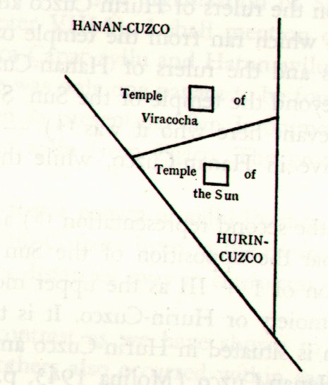 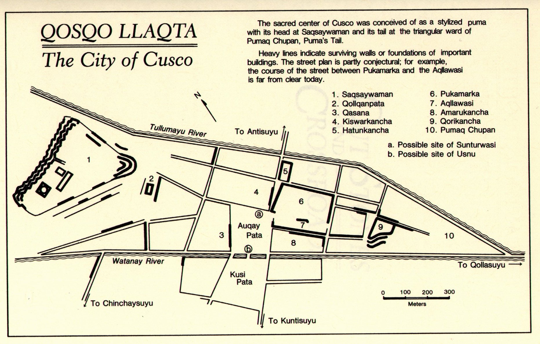 The Temple of the Sun was connected with the lower part, where water should have accumulated due to the force of gravitation. The flow has been beautifully illustrated at the Temple of Kukulkan (Viracocha, Quetzalcoatl, the Winged Serpent): 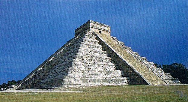 ... Behind me, towering almost 100 feet into the air, was a perfect ziggurat, the Temple of Kukulkan. Its four stairways had 91 steps each. Taken together with the top platform, which counted as a further step, the total was 365. This gave the number of complete days in a solar year. In addition, the geometric design and orientation of the ancient structure had been calibrated with Swiss-watch precision to achieve an objective as dramatic as it was esoteric: on the spring and autumn equinoxes, regular as clockwork, triangular patterns of light and shadow combined to create the illusion of a giant serpent undulating on the northern staircase ...
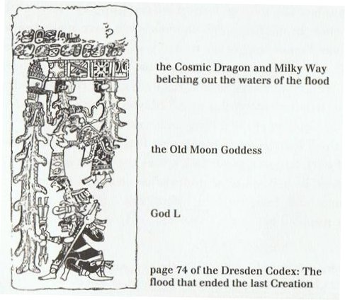
The Arabs had their 2nd Spout (Al Fargh al Thāni) rising with the Sun at 0h. This was 16 days after their 1st Spout (Al Fargh al Mukdim). 53 ('February 22) - 37 ('February 6) = 16. Then came Terminalia, the end of the year. The end page of the Mayan Dresden Codex illustrates the deluge as the result of a pair of spouts:
|
||||||||||||||||||||||||||||||||||||||||||||||||||||||||||||||||||||||||||||||||||||||||||||||||||||||||||||||||||||||||||||||||||||||||||||||||||||||||||||||||||||||||||||||||||||||


