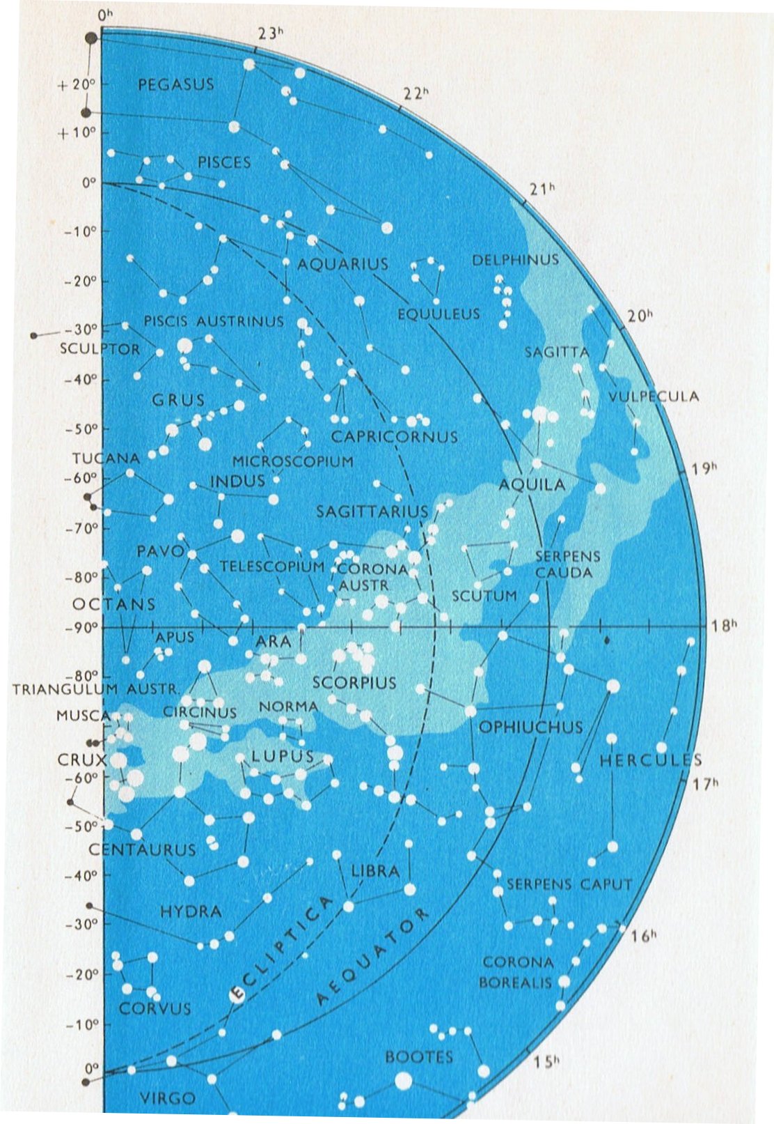
16. Now we are standing on firm ground. The Southern Cross was a kind of Tree and it served as a universal time-piece south of the equator - and what better reason could there be for placing Acrux in position 4 in the C text - i.e. comparable to the ancient place of Aldebaran north of the equator. ... Whittier said, in his Cry of a Lost Soul: 'The Cross of pardon lights the tropic skies'; which is correct for our day, as it is not now entirely visible above 27º 30' of north latitude. It was last seen on the horizon of Jerusalem - 31º 46' 45'' - about the time that Christ was crucified. But 3000 years previously all its stars were 7º above the horizon of the savages along the shores of the Baltic Sea, in latitude 52º 30' ... Von Humboldt adds: The two great stars, which marks the summit and the foot of the Cross, having nearly the same right ascension, it follows that the constellation is almost perpendicular at the moment when it passes the meridian. This circumstance is known to the people of every nation situated beyond the Tropics or in the southern hemisphere. It has been observed at what hour of the night, in different seasons, the Cross is erect or inclined. It is a time piece, which advances very regularly nearly four minutes a day, and no other group of stars affords to the naked eye an observation of time so easily made. How often have we heard our guides exclaim in the savannahs of Venezuela and in the desert extending from Lima to Truxillo, 'Midnight is past, the Cross begins to bend' ... Crux lies in the Milky Way, - here a brilliant but narrow stream three or four degrees wide, - and is noticeable from its compression as well as its form, being only 6º in extent from north to south, and less in width, the upper star a clear orange in color, and the rest white; the general effect being that of a badly made kite, rather than a cross ...
... 'Two thousand miles of empty ocean and the deeps of the Chile Basin separate Easter Island from the west coast of South America. A due-east course would lead voyagers from the island to make landfall in Chile. But a course somewhat to the north of east might bring a ship eventually to the safe haven of the bay of Paracas in Peru, which lies on a meridian exactly 180 degrees of longitude east - and west - of the temples of Angkor in Cambodia. We came across the water from the north in a small open boat, skirting the arid Balestas islands, now a marine sanctuary, and heading for the Paracas peninsula, where rolling sandstone hills and escarpments drop steeply into the sea. From more than 15 kilometers off-shore we had been able to make out the so-called 'Candelabra of the Andes', first through binoculars and then in direct sight. It lay due south of us, carved into a sloping cliff, looming ever larger in our field of view as we approached.
The scholarly consesus is that this huge earth-diagram could easily be 2000 years old and is most likely to have been the work of the same people who created the better-known Nazca lines which are found inland, some 300 kilometers to the south. This 'Nazca culture', about which very little is known, is thought to have flourished from the second century BC until about 600 AD. The 'Candelabra' has a rectangular, box-like base, enclosing a circle, out of which rises the representation of a wide central vertical bar, more than 240 meters in length, running north to south. This is crossed, about one-third of the way up, by a triangular contraption running east to west for some 120 meters, supporting two shorter vertical bars. All three bars are surmounted by curious patterns generally interpreted as flames or rays of light. Because of its auspicious geodetic location half-way round the world from Angkor and 108 degrees west of Giza - sites that both 'resemble the sky' by modelling specific constellations on the ground - we have naturally considered the possibility that the Candelabra could be a work of celestial imitation. What particularly invites this enquiry is the orientation of the diagram. It is set very closely to true north-south, the meridian of the sky, the great dividing-line across which astronomers in all cultures have traditionally observed the 'transits' of stars. The Candelabra was intended by its designers to be seen from the north. Indeed, there is no other perspective from which it may be satisfactorily viewed: the observer must face south towards the sloping escarpment on which it is carved. Examining the diagram from the base up naturally draws the eyes towards the southern sky above the escarpment, and specifically towards the south meridian. Although it may be entirely coincidental, computer simulations tell us that at around the hour of midnight on the March equinox 2000 years ago - the epoch in which the Candelabra was probably made - the constellation known as Crux (the Southern Cross) would have been seen lying on the south meridian at an altitude of 52 degrees. At that moment an observer positioned on a boat as we now were, about a kilometre north of the Candelabra, would have seen the Southern Cross suspended in the sky directly above the great cliff diagram ...
... In Norse mythology, Ratatoskr (drilling tooth, sometimes anglicized Ratatosk) is a red squirrel who runs up and down with messages in the world tree Yggdrasill and spreads gossip. In particular he ferried insults between the eagle at the top of Yggdrasill, and the dragon Níðhöggr beneath its roots ... |


