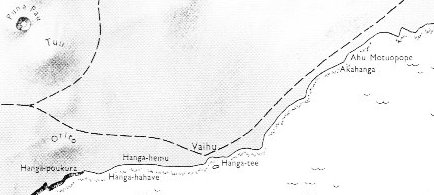
4. The landing of the explorers at Hanga Te Pau and drawing up their canoe explains haga in the name, it is a bay suitable as a harbour. According to The Eighth Island it is located on the southern coast between Hanga Pau Kura and Vaihu:
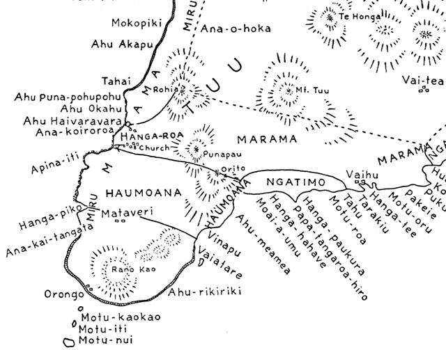
Hanga Pau Kura seems to be named Hanga-poukura on the map above. Although Barthel does not equate Hanga Pau Kura with Hanga Te Pau, I think the names and the general location is leading us to conclude it ought to be the same place: 'The canoe of the explorers lands on the shore below Vinapu at Hanga Te Pau' (The Eighth Island, p. 69). A map from Alfred Métraux, Ethnology of Easter Island, locates Vinapu for us:
According to the first of the maps above the high and steep coastline ends where Hanga-poukura is located, i.e. it is should be the natural harbour for someone wishing to reach Vinapu. But according to the more detailed map of Métraux Hanga-paukura is located more to the east. And pau is definitely not equal to pou, rather its opposite. We must look out of wordplays. Yet, the information of Barthel does not make sense. It is not possible to locate Hanga Te Pau below Vinapu and at the same time put it between Hanga Pau Kura and Vaihu. The difficulty may be due to a misconception - Hanga Te Pau is not located in the normal geography of the island, it is a place in time. Pau is the key word, and it is probably alluding to Puna Pau (cfr top left on the first map):
The basic idea seems to be 'finished' (out of breath, out of water). Thus Hanga Te Pau could mean the harbour at the end of the journey. The last words on page 17 are he vari ki hanga.te pau:
Vari means a curve and also paupau means a curve. Possibly a curve is a sign of approaching end. Old people no longer have straight backs. |

