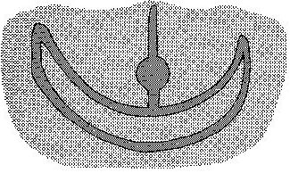
The idea to map the features on the ground (Earth) to fit the patterns of the stars in the sky is not farfetched, given that we consider how Ragi and Papa were torn apart to let in the light, how their primal embrace was disrupted. Sky should have left his imprint on Earth. The south side of Easter Island was mapped from the path of the Moon, we can read in Barthel 2. And the north side was mapped after the path of the Sun. The canoe of the Moon lies lower down (south) than the domain of the Sun.
In other words, by moving in space you can travel also in time. When the explorers (cfr at ragi) under the command of Ira moved up from Hanga Te Pau (presumably day 366 at Gb5-12) they also moved in time: ... The canoe continued its exploration and in a sweep sailed on to Hanga Te Pau. They went ashore and took the food with them. They pulled the canoe onto the beach and left it there. Ira sat down with all the other (companions) and spoke to Makoi: 'You shall mark the land for me and make it known (by its names)!' After that, Ira spoke these words: 'This is the digging stick (? ko koko), Kuukuu. You shall work the land for me and plant the yam roots!' Makoi named the place Hanga Te Pau, 'the landing site of Ira'. So that they would remember (? he aringa, literally, 'as face'), the open side of Hanga Te Pau was given this name. Ira got up. They all climbed to the top of the hill. They climbed up on the tenth day of the month of June ('Maro'). They reached the side crater (te manavai) and looked around carefully. Makoi said, 'This is the Manavai of Hau Maka'. They climbed farther and reached the top. They saw the dark abyss and the large hole (of the crater Rano Kau). They all said, 'Here it is, young men, the dark abyss of Hau Maka.' They made camp and constructed a house. Kuukuu got up, worked the ground, and heaped up the earth for the yam roots ... The naming of the features of the land is the work of Makoi and he must - I think - follow the stars in the sky to get it right. Kuukuu is ordained to look in the opposite direction, to use the digging stick (like Khnum), and this must be done at the proper time - and therefore also at the proper place, which motivates the path the explorers took: ... Hanga Te Pau lies halfway between the places Kioe Uri and Piringa Aniva, both of which are also designations for the month of June. In this sense, Hanga Te Pau occupies the correct position in the time-space scheme. Instead of turning to the right (facing the land) in their search for the residence of the king, the explorers turn in the opposite direction. From a chronological point of view, this turning to the left signifies a going back to the two winter months that have passed. Considering the condition in the new land, building a house on the rim of the crater and establishing a yam plantation are indeed suitable activities for the new settlers ... Once again we find 2 winter months preceding the front side of the year. |
