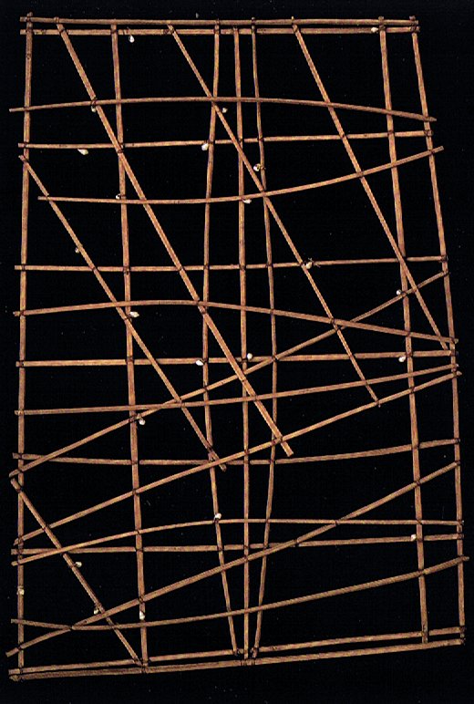
2. Sailing charts, rib charts, should be mentioned here. An example from the Marshall Islands (ref. D'Alleva) was made from 'wood, shells, and vegetable fibres':
"In order to traverse these great distances, the Lapita must have been skilled navigators and sailors, just like their descendants, the Polynesians. Navigational techniques still in use in Micronesia may provide insight into the ancient traditions of Lapita and Polynesian seafaring. In traditional navigational schools on Puluwat in the Caroline Islands, students learn how to sail outrigger canoes. As Puluwat sailors conceptualize a voyage between two islands, it is the islands that move rather than the canoe: the starting point recedes as the destination approaches. Puluwat map the skies by the constellations and the ocean by its distinguishing features; islands, reefs, swells, areas of rough water. Similarly, a Marshall Islands stick chart uses shells to indicate specific islands and patterns of sticks lashed together to illustrate currents and common wave formations in a form that is both supremely functional and aesthetically appealing." (D'Alleva) Before we condemn the Polynesians for their ignorance when thinking that the canoe is standing still while the island in front is moving towards them, we should consider our own similar behaviour: We say that the sun and the stars move across the sky from east to west, when we instead ought to say that it is the earth which is turning. Reality is hard to face. Therefore we prefer to say the sky is moving - not we down on earth. If we often used to travel long distances by canoe we would therefore (presumably) say that the water is moving - not we (in the canoe). |